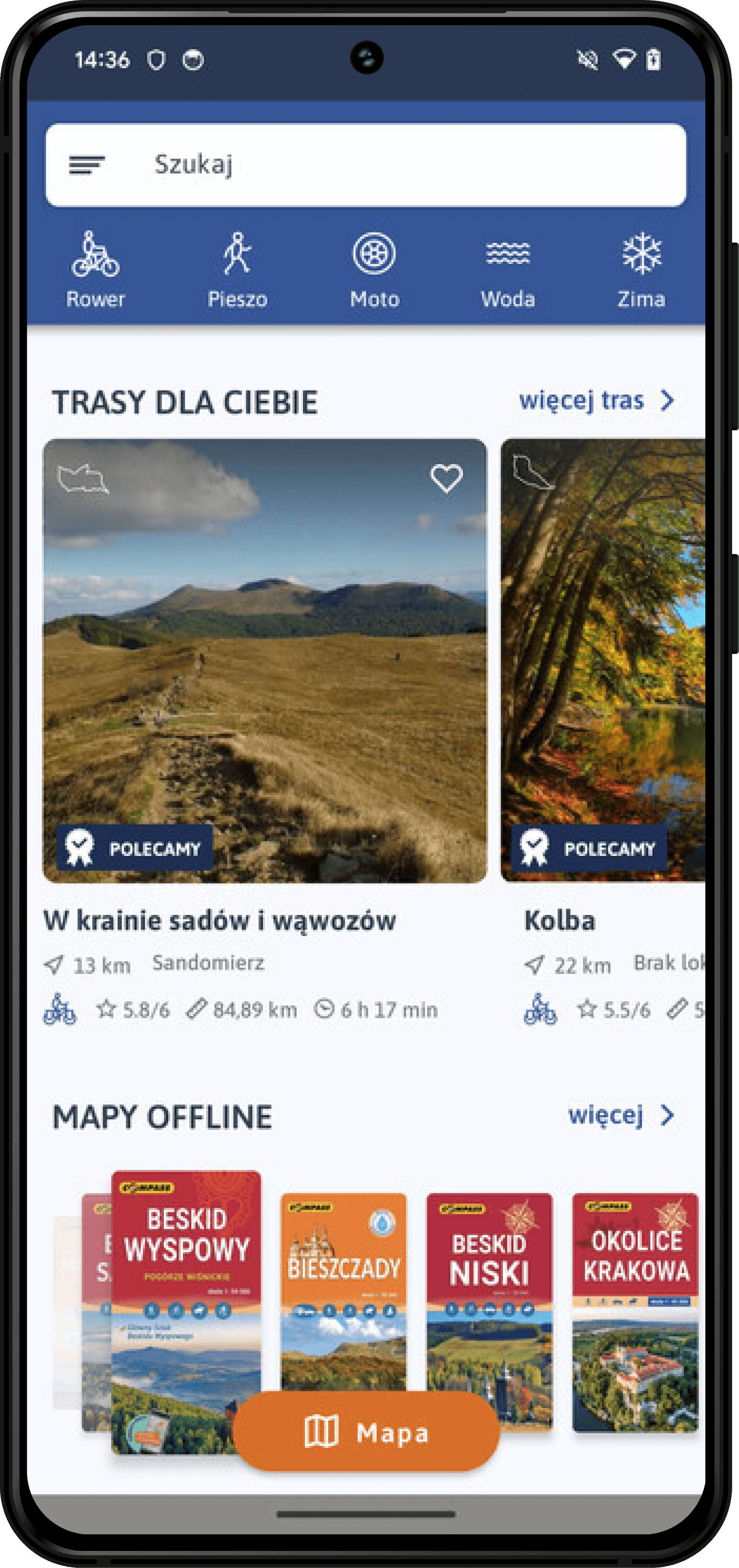
trasy, szlaki i mapy turystyczne


W Traseo znajdziesz setki pomysłów na wycieczki rowerowe, piesze, motocyklowe, kajakowe, a nawet konne. Przy pomocy planera w łatwy sposób wyznaczysz trasę, zapiszesz ją w Mojej Mapie i otworzysz ją w aplikacji mobilnej Traseo. Podkłady mapowe zawierają kolorowe szlaki turystyczne.
Mapy turystyczne Traseo zawierają szlaki turystyczne piesze oraz rowerowe. Możesz je pobrać na telefon i korzystać z nich w trybie offline. Poza naszymi autorskimi podkładami mapowymi znajdziesz tu również dokładne mapy turystyczne renomowanych wydawnictw kartograficznych.
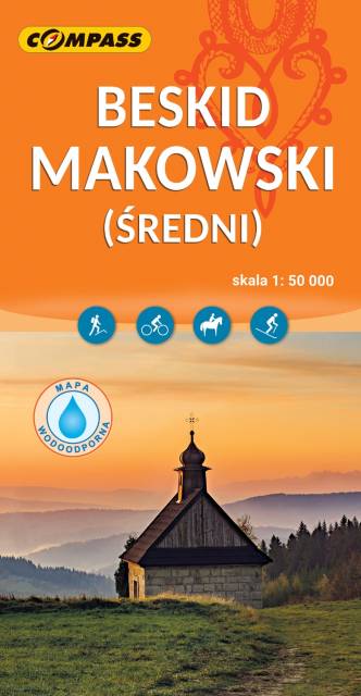
Mapa Beskidu Makowskiego (zwanego także Średnim lub Myślenickim) swoim zasięgiem obejmuje także fragmenty Beskidów: Małego, Żywieckiego i Wyspowego. Najwyższym szczytem jest Mędralowa, pozostałe pasma osiągają wysokość do 700 – 800 m n.p.m. Beskid Makowski jest stosunkowo mało popularny wśród turystów, chociaż jest też dosyć gęsto zaludniony. Na mapie przedstawione zostały szlaki piesze oraz trasy rowerowe, zastosowano także cieniowanie w celu uzyskania wrażenia plastyczności terenu. Mapa offline, którą można zakupić w aplikacji Traseo na urządzenia mobilne, zasięgiem obejmuje tereny od Wadowic na zachodzie po Dobczyce i Rabkę-Zdrój na wschodzie. Rok wydania 2023
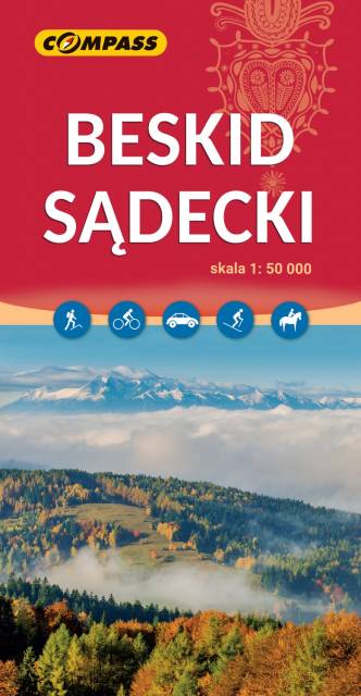
Mapa offline wydawnictwa Compass, którą można otworzyć na telefonie w naszej aplikacji Traseo, obejmuje cały obszar Beskidu Sądeckiego, od doliny Dunajca na zachodzie i północnym zachodzie, po Krynicę, Tylicz i Muszynkę na południowym wschodzie. Zawiera także obszar Małych Pienin, Pieninek oraz część Pienin Właściwych. Na mapie znajduje się również fragment Beskidu Niskiego: Gór Grybowskich. Rok wydania 2023
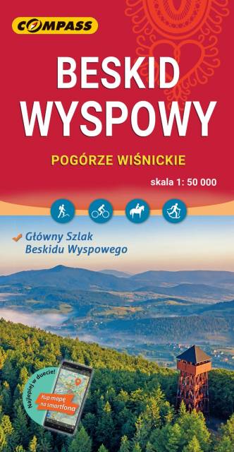
Mapa w wersji elektronicznej, którą można otworzyć jako jeden z podkłądów offline w aplikacji mobilnej Traseo. Mapa wydawnictwa compass obejmuje zasięgiem Beskid Wyspowy oraz Pogórze Wiśnickie i wschodnią część Pogórza Wielickiego. Od północy ogranicza ją Brzesko i Bochnia, na południu Rabka i Stary Sącz, na zachodzie - Jordanów, a na wschodzie - Nowy Sącz. To świetna alternatywa dla mapy drukowanej. Rok wydania: 2023
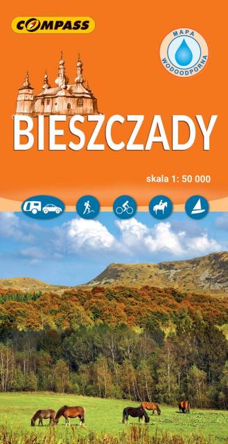
Mapa Bieszczady zamyka się w granicach: Lesko i Ustrzyki Dolne na północy, Komańczę na zachodzie, granicę z Ukrainą na wschodzie. Na południu nowe wydanie zostało poszerzone o fragment Parku Narodowego Połoniny po stronie słowackiej. Obszar mapy obejmuje: Bieszczadzki Park Narodowy, Jezioro Solińskie i Myczkowieckie, Góry Sanocko-Turczańskie, fragment pogórzy (Bukowskie i Leskie) oraz najpopularniejsze miejscowości turystyczne: Ustrzyki Górne i Dolne, Wetlina, Cisna, Komańcza, Solina, Lesko. Rok wydania 2024

Mapa Beskidu Niskiego wydawnictwa Compass to mapa offline na urządzenia mobilne w skali 1:50 000 prezentująca obszar Beskidu Niskiego. Zasięg mapy obejmuje tereny od Krynicy-Zdrój i Grybowa na zachodzie po Komańczę i Szczawne na wschodzie oraz Gorlice na północy po polsko-słowackie pogranicze na południu. Rok wydawnia 2023
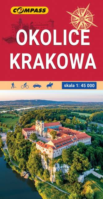
Mapa Krakowa i okolic przedstawia najważniejsze tereny rekreacyjne tego rejonu, m.in. Puszczę Niepołomicką, Dolinki Podkrakowskie i Ojcowski Park Narodowy. Obszar mapy "Okolice Krakowa" zamknięty jest przez Bochnię na wschodzie, Wadowice na zachodzie, Sułoszową na północy oraz Myślenice na południu. Rok wydania: 2022
Skorzystaj z kilku trybów planowania, w łatwy sposób wyznaczysz trasę dostosowaną do wybranej aktywności. Planer podpowie Ci, czego możesz się spodziewać na trasie: rodzaj nawierzchni, dystans, przewyższenia. Przypnij zaplanowaną trasę do Mojej Mapy i korzystaj z niej w aplikacji mobilnej Traseo.
Na blogu Traseo znajdziesz porady dotyczące odpowiedniego przygotowania przed wyruszeniem na szlak górski, wyjazd kempingowy czy wycieczkę rowerową. Porady przeplatamy zestawieniami np. 10 najpiękniejszych miejsc w górach czy TOP5 tras pieszych i rowerowych w Polsce. Zapraszamy do czytania!
Zainstaluj darmową aplikację mobilną Traseo. Nagrywaj własne ślady podczas wycieczek lub nawiguj po trasach społeczności. Szukaj inspiracji wycieczkowych, korzystaj z podkładów offline, autorskich map turystycznych Traseo i map od wydawców. Rób zdjęcia, dodawaj opisy, możesz podzielić się trasą z innymi użytkownikami Traseo lub zachować jako prywatną tylko dla siebie!
Szlak Orlich Gniazd, Żelazny Szlak Rowerowy, Szlak Bursztynowy, Szlak EuroVelo R10 czy Główny Szlak Beskidzki to tylko kilka przykładów popularnych szlaków turystycznych, których oficjalne przebiegi znajdziesz w aplikacji i na portalu Traseo
Górski szlak na Giewont, Pilsko lub Skrzyczne. Spacerowy szlak nad Morskie Oko. Trasa na Babią Górę, Łysicę i w Błędne Skały – to tylko kilka górskich szlaków turystycznych prowadzących do uwielbianych przez Polaków miejsc. W Traseo znajdziesz ślady GPS, dzięki którym możesz podążać wybraną trasą.
Inspiracji na wycieczki rowerowe najlepiej szukać na portalu lub w aplikacji mobilnej Traseo. Poniżej znajdziesz najlepsze trasy rowerowe w Polsce. Z łatwością odkryjesz ścieżki rowerowe w okolicy Warszawy, Wrocławia, Krakowa, Gdańska. Natomiast przy pomocy planera na Mojej Mapie wyznaczysz trasę w kilku trybach: rower miejski, MTB, turystyczny, szosowy.


